|
|
|
Imaging Radar for the NearshoreWave Analysis with Radar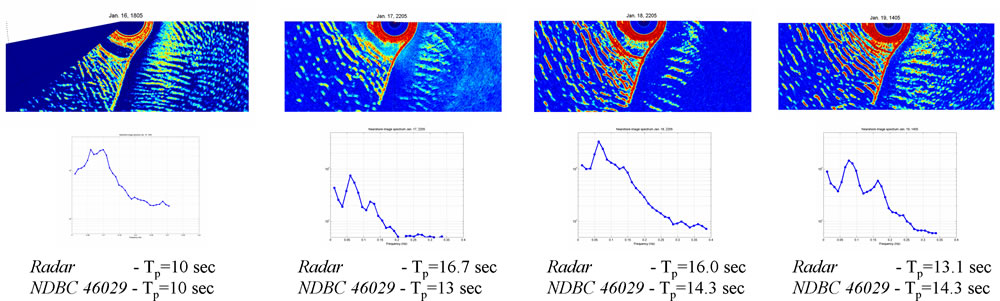
Top: Portions of single radar images expanded to show the area near Benson Beach, WA. Waves were consistently breaking as far out as 1 km from shore leading to the bright radar returns as far out as the end of the north jetty.
Bottom: Frequency spectra calculated from radar pixel time series located approximately 600 m offshore of Benson Beach. Estimated peak periods are compared with those measured by NDBC Buoy 46029 located xxx.
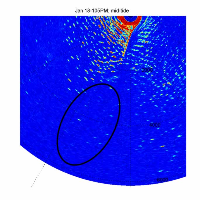
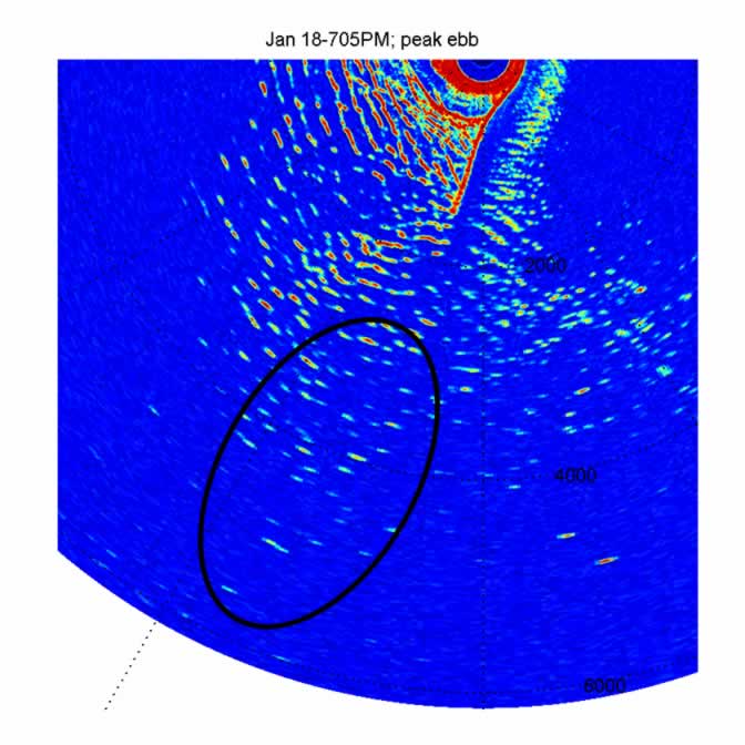
The flow out of the Columbia River varies depending on the stage of the tide and during periods of strong currents the wave field can be significantly modified. For example, during strong ebb flows waves over the Columbia River Bar are highly steepened and often break, which leads to dangerous navigational conditions.
|
|||||||||||||||||
|
OSU College of Engineering |
||||||||||||||||||
|
|