Project Background
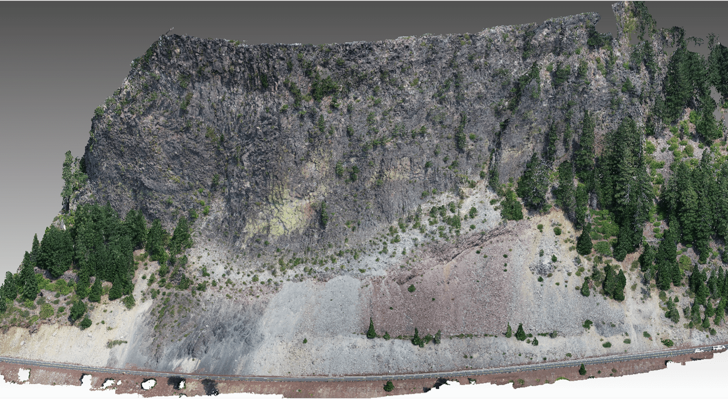
Figure 1: 3D pointcloud of one of the sites surveyed in Oregon (Hogg Rock) located along HWY 20 in Oregon's Cascade range. Peak of rockslope is 500ft above road for scale.
Given the negative economic and community impacts of rockfalls, a targeted method for identifying the highest-risk rockfall areas along state routes is crucial to ensure a safe, efficient transportation system that can function during emergency events such as a Cascadia earthquake, while also maximizing the use of ODOT’s limited mitigation funding. Oregon’s highways traverse particularly unstable terrain throughout the state. Steep slopes, weak soil and rock, high rainfall, and unfavorable geology result in frequent maintenance, system unreliability due to frequent closures and restrictions, and safety hazards due to landslides and rockfalls.
Currently, rockfalls are rarely stabilized and addressed beyond initial cleanup, even though the safety risk from rockfalls is high. Further complicating rockfall mitigation planning, those sites currently mitigated are nearing the end of their design lives. Moreover, none of these installed mitigations are designed for seismic events—which greatly increase rockfall activities and associated damage.
Objectives
The overall aim of this research is to provide a comprehensive and targeted method using a quantitative, data-driven approach to proactively identify high-risk rockfall locales for selected mitigation to ensure ODOT’s critical corridors remain open during emergency events. Specific objectives include:
- Develop lidar based rockfall assessment workflow using RAI to supplement manual rockfall analysis.
- Identify highest-risk seismic rockfall areas along five Oregon lifeline route segments by establishing current failure rates using change detection techniques to create a pre-seismic “baseline failure rate"
- Provide recommendations of potential mitigation strategies based on predicted rockfall energies from RAI assessment.
- Identify regions of seismic instability for targeted mitigation to prepare for seismic events based on observed failure activity from seismically-driven rockfalls in New Zealand from the Canterbury Earthquake Sequence.
- Augment the RAI screening method by developing predictive models to be used for seismic predictions at each site allowing for scaling of rockfall activity rates and failure depths based on predicted seismic inputs.
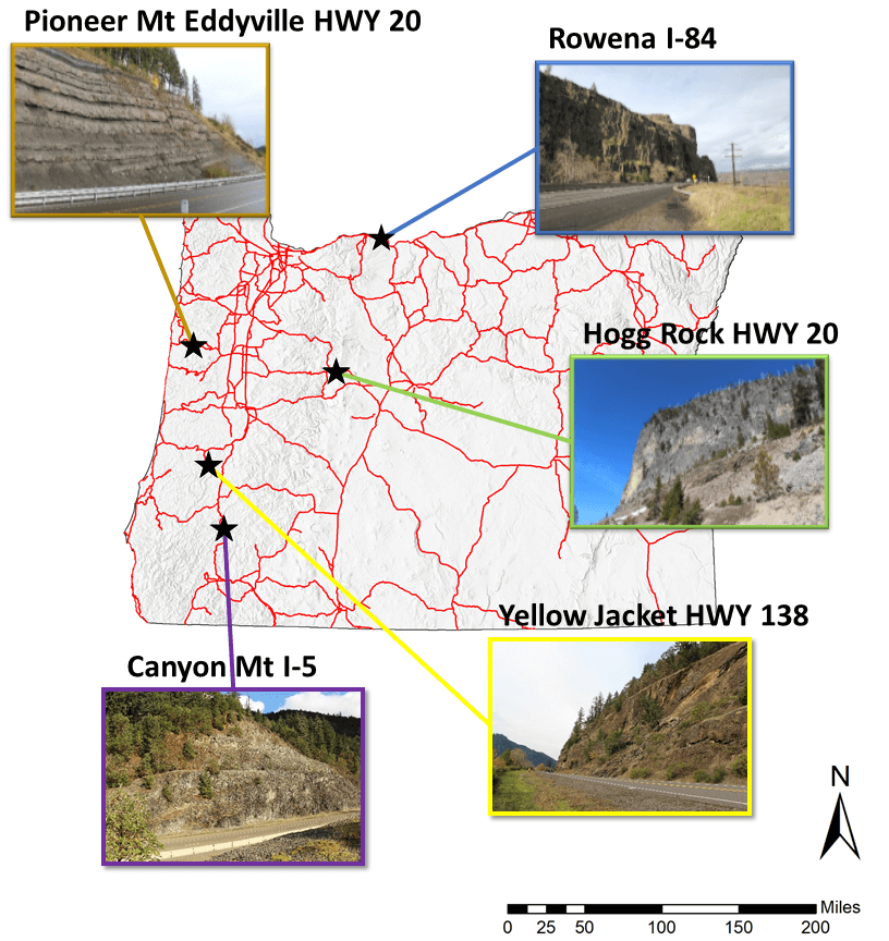
Figure 2: Map of Oregon Showing the location of the five study sites surveyed in this project: Canyon Mt, Hogg Rock, Pioneer Mt Eddyville, Rowena and Yellow Jacket and their associated roadway.
Benefits
Proactive management of highway slopes is needed to ensure safety and economic mobility, especially during emergency situations. This research:
- Facilitates increased capacity for rapid assessment of rock slope stability by supplementing manual efforts with mobile lidar methods
- Identifies regions of seismic instability for targeted mitigation to prepare for seismic events
- Enables projection of future impact analysis from rockfall activity by establishing a current baseline risk.
This work intersects and complements multiple ODOT agency efforts including the seismic lifeline and resiliency planning initiatives and the Unstable Slopes Program. The research also provides another mechanism to obtain additional value from the mobile lidar scans being routinely acquired by ODOT Geometronics to support several applications. Importantly, guidelines from this research provide enhanced performance measures to assess management costs, prioritize areas of concern, and assess potential future route planning.
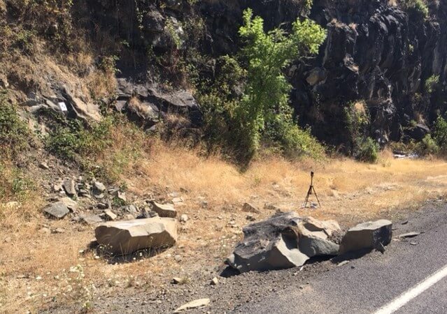
Figure 3: Picture of rockslope failure at one of the sites in Oregon (Yellow Jacket).
Implementation
Geoengineering personnel will use the RAI workflow developed from this research to more comprehensively analyze rock slopes along ODOT corridors. Regions of high-risk rockfall and seismic prone rockfall could be rapidly identified to inform mitigation strategy and prioritization of sites. Project products useable by agency staff and consultants include:
- Guidance manual describing lidar analysis workflow for seismic and non-seismic rock slope assessment.
- A GUI to enable simplified application of this workflow and supporting morphological and change analysis in an intuititve, efficient manner.
- Analysis of five high-risk, ODOT highway sections, mapped with rockfall risk ratings using RAI.
- Analysis of mitigation performance from NZ data and literature review, with specific mitigation recommendations.
- A project roll-out short course including presentation materials.
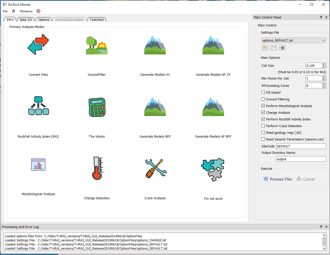
Figure 4: Screen shot showing the home page of the RAMBO (Rockfall Acticity Morphological Bigdata Optimizer) GUI developed during this project.