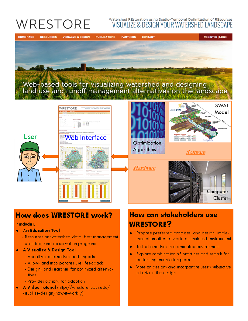
WRESTORE is a web-based, user-friendly, interactive, transparent, and participatory decision support system for helping land owners, government agencies, policy makers, planners, and other stakeholders design a distributed system of conservation practices in their watersheds.
In WRESTORE, web-based tools allow users to test multiple solutions (or, alternatives) for locating and designing conservation practices in a simulated environment of their watershed landscape. Based on the overall performance of the practices in the simulated environment, users can then identify alternatives most suitable to their needs. The interactive framework takes feedbacks from the users and then uses an iterative search-and-learning method to search for better potential solutions that incorporate the users’ feedbacks. In this manner, not only does the tool learn from the users about their needs while searching for better alternatives, the users also learn about how their watershed can respond to various actions or changes on the landscape and how to manage their landscape within the constraints of their physical and socio-economic environment.
For example, a farmer concerned with the problem of erosion on her/his land can explore multiple types of best management practices and locations where the practices can be implemented on her/his landscape.