Start Date: April 1, 2014
PI: Dr. Olsen
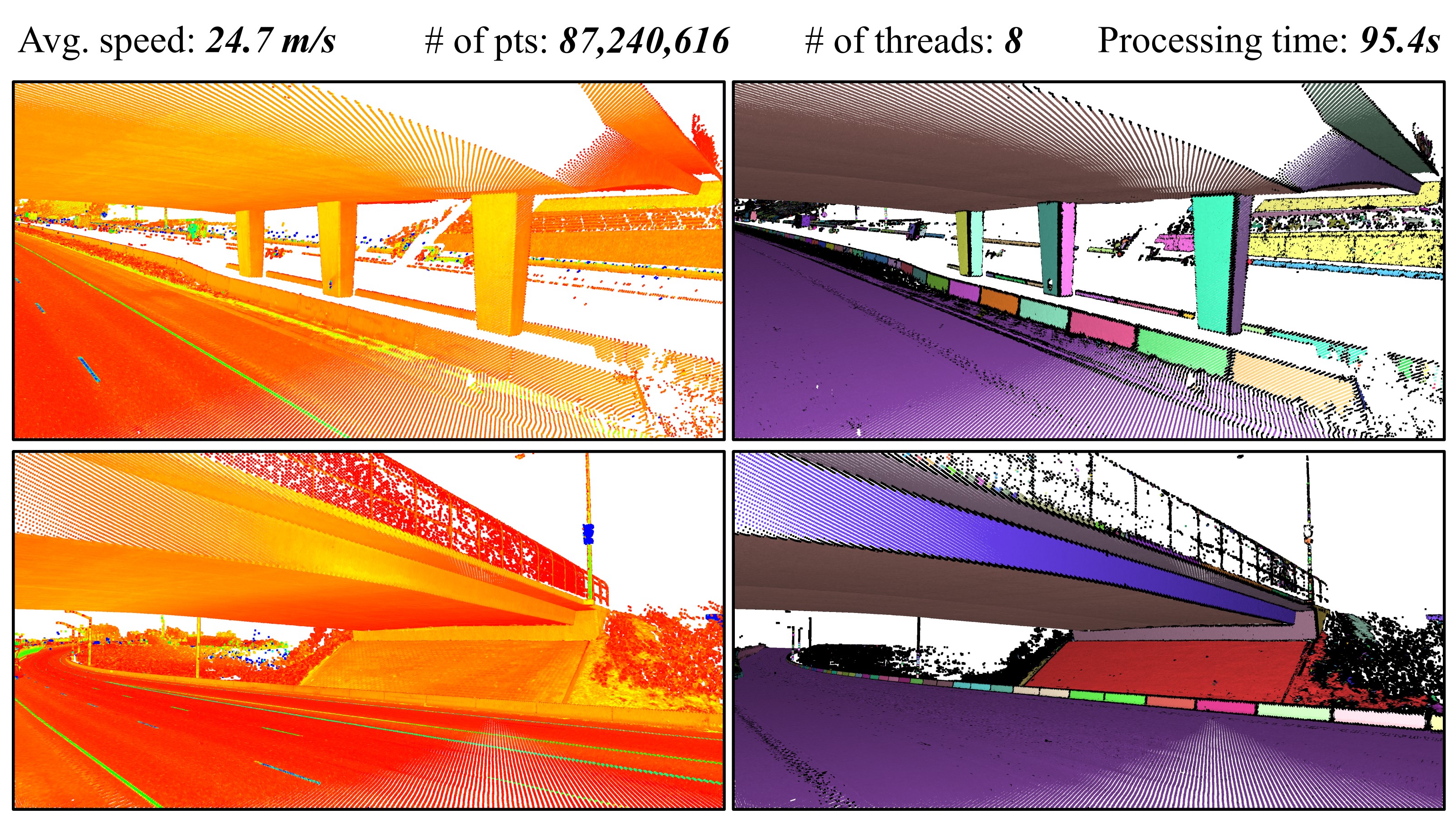
(Mo-norvana segmentation)
The primary research focus of this Faculty Early Career Development (CAREER) Program award is to efficiently identify and extract meaningful information from three-dimensional, geospatial models of transportation infrastructure in a holistic, automated framework, enabling broader application. Advanced mapping technologies such as laser scanning produce three-dimensional maps, creating highly detailed scenes that can be virtually explored and queried for a diverse range of purposes including infrastructure management, digital terrain modeling, cultural heritage, flood plain delineation, and landslide detection. However, tradeoffs exist between the detail and scale provided by these technologies and the immense size of the resulting datasets. This complexity can strain the most powerful computational resources and require a steep learning curve to exploit the data. While recent tools have made significant progress, only a small and piece-meal portion of information can be automatically extracted from these rich datasets compared to what is actually available. Key scientific questions to be addressed through this research include (1) What inherent attributes of an object and associated representation in laser scan data and supporting imagery are most beneficial to accurately identifying and extracting an object?, (2) How can neighboring features and context of an object help with rapidly identifying it within geospatial data?, and (3) How can an abridged framework be developed to improve information extraction from laser scan data to consider the broad range of transportation objects? This overarching framework will consider a broad range of object types, incorporate advanced system information and data structuring, function in noisy, real-world environments, and focus on datasets covering large spatial scales consistent with transportation infrastructure management. Products resulting from this framework include a transportation infrastructure object properties database, fully-classified benchmark datasets, new algorithms, and supporting code, which will be made publicly available.
Well-maintained transportation infrastructure is vital to our economy as well as public safety. Most transportation agencies charged with maintaining infrastructure are trying to develop a comprehensive methodology for inventory, maintenance and management of their immense assets. In many cases, the available resources are reduced while maintenance demands still increase. This research will provide timely solutions to map and digitally manage these assets more efficiently and cost-effectively than current practices. Although primarily focused on transportation, the computational methods and techniques will be applicable and extendable to a wide range of other applications such as land management, urban mapping, and robotics. This project also will provide students with multi-disciplinary education and training in geospatial analysis, computer science, transportation, and engineering. Despite the high demand for geospatial expertise today, educational opportunities are limited and challenging because of the rapid evolution of the supporting technologies. As a result, the U.S. has an insufficient number of geospatially-trained students entering the workforce to meet the ever-increasing demand utilizing geospatial information throughout society. This project will enhance geospatial education through activities ranging from exposure at public events to training camps for high school age students to creation of a model civil engineering geomatics graduate program.
Publications: