Water Surface Temperature Mapping on the Iron Gate Reservoir with Landsat 8 TIRS
Water temperature is a driver for a number of physical and biological processes and is known to impact fish health and water quality from organic and inorganic contaminants. With a number of different dam release scenarios having been proposed for the Klamath River, the availability of multi-temporal water surface temperature data could improve models for evaluating the impacts.
 |
| In Summer 2016, an OregonView-sponsored research team, led by OSU graduate student, Kory Kellum, tested procedures for using Landsat 8 (L8) TIRS bands and in situ data for generating multi-temporal water surface temperature data products for the Iron Gate Reservoir, impounded by the Iron Gate Dam on the Klamath River. |
Procedures:
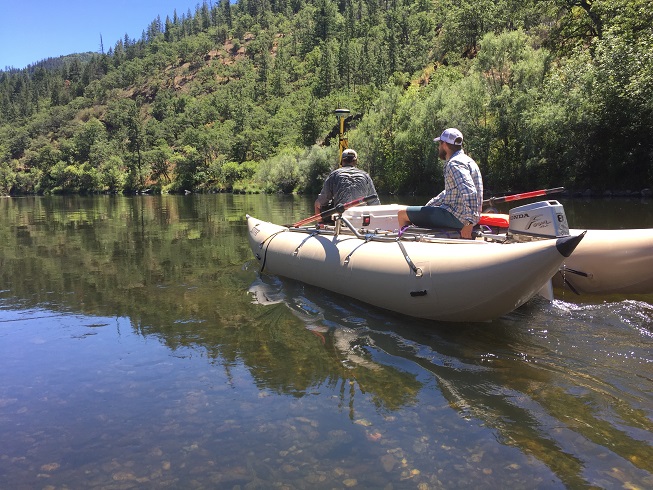
- Step 1: Synchronizing in situ data collection with L8 satellite overpass: on July 20, 2016, the team used infrared thermometers operated from a SOTAR inflatable cataraft (pictured) to acquire 19 water surface temperature measurements throughout the reservoir within ± 2 hours of the L8 overpass. Sample sites were positioned with RTK GPS on the boat.
- Step 2: Image preparation: georeferenced L8 scenes from the July 20 overpass were downloaded from USGS Earth Explorer. The Band 10 image was clipped to the reservoir boundary in ArcGIS.
- Step 3: Radiometric processing: in ArcGIS Raster Calculator, L8 band 10 DNs were converted to TOA spectral radiance values using linear transformation parameters available from USGS. These radiance values were then converted to at-satellite brightness temperatures using the thermal constants provided in the metadata file and Planck’s law. Next, at-satellite brightness temperature values were converted to water surface temperature using an assumed emissivity of 0.972.
- Step 4: Linear fit to reference data: the final step in the process was to perform a linear fit to the in-situ water surface temperatures obtained by the field team.
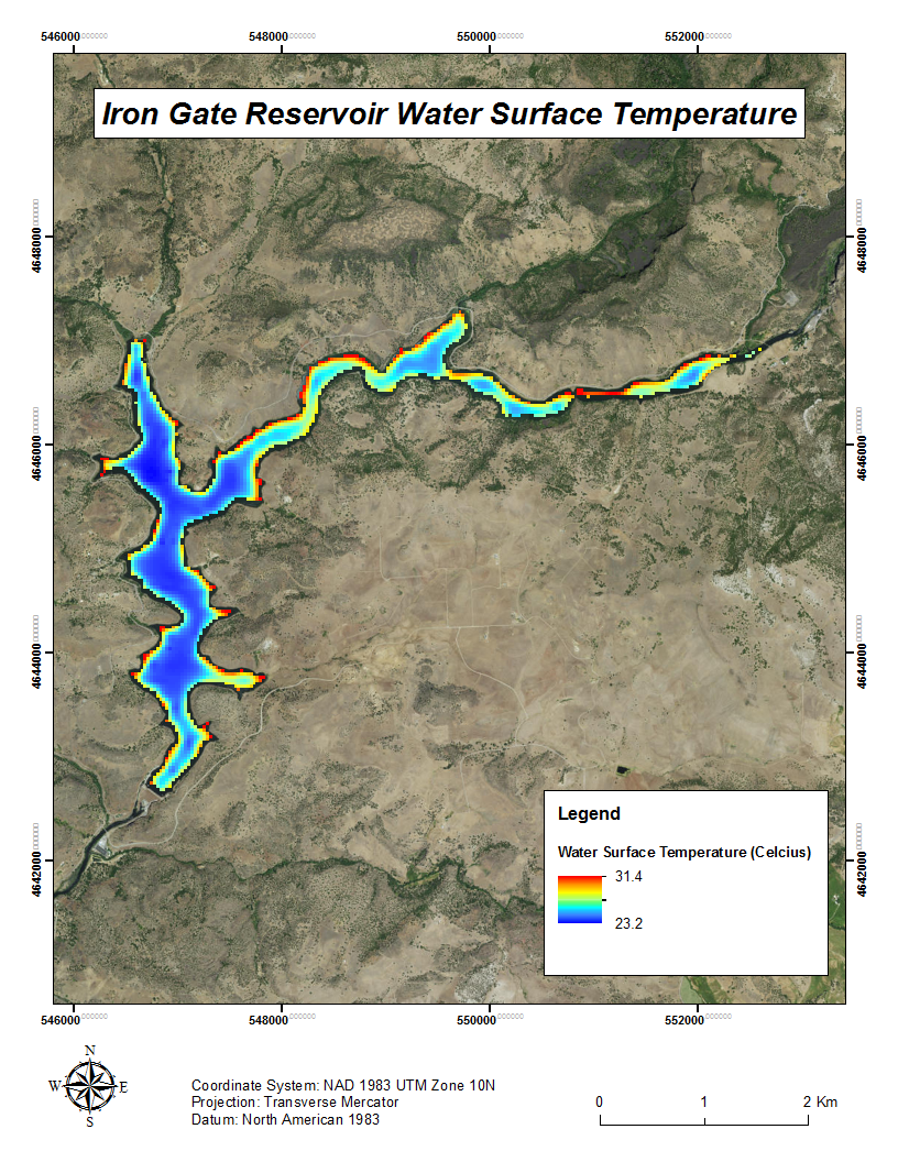
The output of this project includes a water surface temperature map for Iron Gate Reservoir on July 20, 2016 at 18:50 GMT (pictured below), which can be downloaded here.


