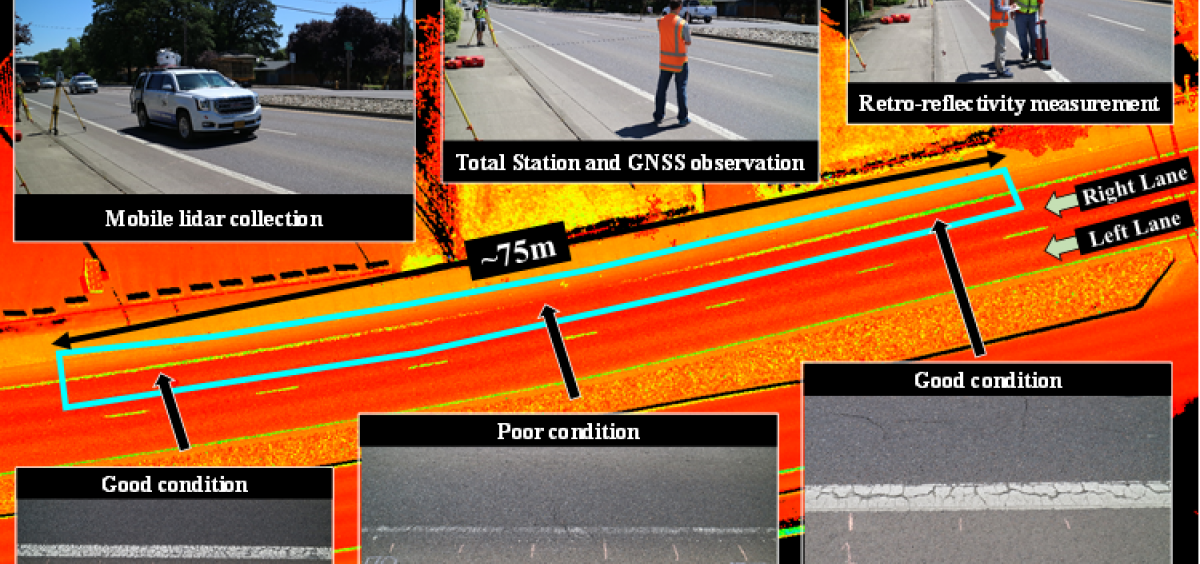
The Civil Engineering Geomatics program at Oregon State University is a leading center for research and education in geomatics applied to civil engineering and other fields. Our students also collaborate with researchers in a wide variety of disciplines. A short list of focus areas includes:
OSU has access to a large amount of state-of-the-art equipment and software for research thanks to a memorandum of understanding between OSU, Leica Geosystems, and Kuker Ranken. Students will be trained on the latest equipment available in industry practice. Leica Geosystems has provided powerful software (Leica Cyclone Register 360, Cyclone 3DR, and Infinity), which are used in OSU's courses for survey and scan data processing. Maptek I-Site also provides licenses to OSU for Maptek Point Studio. In addition, OSU maintains licenses for a wide variety of geomatics applications for research needs as well as develops its own internal software for data processing.